Return to Contents Page
Return to Highway Page


Printer-friendly version

Page Contents
Baja California Information Pages
Crossing the Border


    Diagram


Border Crossing Diagram


    Waiting Times


When returning north across the border, the waiting times can sometimes reach to well over an hour. Weekends are the most crowded times, followed by commuter times on working days. If you wish to check on current waiting times, here are some San Diego phone numbers:

San Ysidro:  (619) 690-8999

Otay Mesa:  (619) 671-8999
(Thanks to Patricia Beller for supplying these numbers.)

There are now several Internet alternatives.

Here is the TelNor website for the webcams covering the San Ysidro and Otay Mesa crossings:

TelNor Webcams    (Thanks to "Wild Bill" Wiederhold for this information.)

Here is a website (in Spanish) which provides current information:

www.fronteratij.com/garitas    (Also passed on by "Wild Bill" Wiederhold.)

ByTheBorder.com also provides current information:

http://www.bytheborder.com/cgi-bin/english/traffic/index.cgi


    Tijuana - Driving South


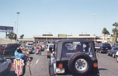
If you are heading south from San Diego, Tijuana is a necessary evil (unless you invest 40 more miles of driving and cross the border at Tecate). The best (and quickest) route is to take U.S. I-5 or I-805 south to the border crossings.

Highways I-5 and I-850 merge just north of the border crossing. Prior to the merge point there are several exits for San Ysidro - this is where you should take care of insurance and money exchange, if you haven't already done so. Getting Mexican insurance on your vehicle is a must! (See the Auto Insurance Page for more information.)

Exchanging US dollars for pesos is not required, but it's a smart way to save money (exchanges made along the highway usually result in a very poor exchange rate for the tourist). Warning: Don't use an exchange house ("Casa de Cambio") that charges a commission!

There are two border crossings to choose from: San Ysidro and Otay Mesa. Here are some of the pros and cons as I see it (other experienced Baja travelers will certainly have differing views). I almost always use the San Ysidro crossing as I find it more convenient to the toll road, my usual route south.

Consideration San Ysidro Otay Mesa
Drive to the Toll Road Shorter, less driving
with stoplights, etc..
Greater distance, with lots
of stoplights, etc..
Drive to the Free Road About the same for both crossings. Lots
of stoplights, etc..
Ease of crossing Often very crowded. Much less crowded.
Insurance/Exchange Stop Right on the way. Must drive about four extra
miles to San Ysidro and back.
Obtaining Tourist Card Probably equally good. Migración office at
each crossing.
Hours of operation 24 Hours 6 AM to 10 PM

The Mexican Customs inspection at Tijuana uses the same system as implemented at the Mexican airports - a random selection indicated by a red and green lights. I assume a small computer is making the random selection. If you get a green light there will be no inspection. If you get a red light, you will be shunted off to the right for an inspection.

RVs: Note that all RVs get inspected. This is one case where the random selection process gets turned off!

San Ysidro Border Crossing:
Note: The initial section of this route is new in 2004!

Warning!
After crossing into Mexico, and while still next to the inspection area, position yourself in the second lane from the right (the right-most lane will shortly veer off to connect to local streets).

After the right-most lane turns off to a local street you'll automatically be in the right-most lane as the road crosses a flood channel.

Shortly after crossing the flood channel, traffic will enter from the right -- quickly merge into this new lane and follow it as an exit to the right opens up.

There are signs pointing to Ensenada and Ensenada Cuota - Scenic Road (the toll road). This curving exit drops you into a merge with Calle Internacional, where you are now merging into the "fast lane."

Best to go slow and let the other drivers honk at you. If you miss a turn, keep in mind that the general idea is to parallel the border fence west towards the ocean until the road ("Calle Internacional") bears to the left and merges with a major highway heading west - this highway shortly becomes the Ensenada toll road.

Otay Mesa Border Crossing:
If you haven't taken care of the Mexican insurance and any money exchange, follow I-5 or I-805 down to San Ysidro to take care of those matters - then return north (I-805 a bit shorter) to pick up California Route 905.

From either I-5 or I-805 take California Route 905 east - there are signs directing you to the border crossing. You'll pass a large airport (Brown Field) on your left, and then eventually turn south to the border.

Once you've crossed the border, you have two choices (in a general sense): drive the city streets to the area of the San Ysidro crossing (not recommended) or drive city streets to the circuit road around Tijuana - look for signs for Libramiento. You generally bear to the west and drop down a hill to a crowded area. Continue on the main street southwest (Blvd. Lazaro Cardenas) - this will merge into the circuit road. Finally, you'll reach the San Ysidro route several miles west of that crossing. Continue on to the toll road.

Note: In August of 2007, the U.S. Customs and Border Protection website (http://apps.cbp.gov/bwt) still shows the hours of operation at Otay Mesa as

6AM to 10PM

However, other reports indicate that the crossing is now open 24 hours, 7 days a week. I can't vouch for either claim.


    Tijuana - Driving North


When driving north through Tijuana, I'm always entering Tijuana from the Ensenada toll road. There are two border crossings: San Ysidro and Otay Mesa (the newer crossing). The traditional San Ysidro crossing is the larger and busier of the two - on Sunday afternoons and on holidays expect at least a one hour wait at the crossing (it could be shorter or longer). While Otay Mesa is quicker to cross, it is more difficult to reach on the Tijuana side. To my mind it's a toss up during the crowded times. If it's not a crowded time, then San Ysidro is probably faster. In either case, be prepared to prove to the U.S. Customs agent both your citizenship and the prices of purchases you made in Mexico. The probability of having to do this may be slight, but it is something you should be ready for.

About 3/4 mile after the Ensenada toll road curves right (to the east) and becomes a local four-lane divided highway, begin following the signs to San Diego. The routing changed in 2004 and is now a more direct merge with the circuit highway around Tijuana ("Circuito Independencia"). (On the old routing, you had to make a U-turn to get on the correct side of the circuit highway.)

San Ysidro Border Crossing:

Bear off to the right and follow the signs to San Diego or to the "Garita" (border crossing). The road ("Calle Internacional") eventually parallels the border fence and drops you in a congested area. Follow the street until it "T's" at a stoplight, with all traffic turning left. After the left turn, several lanes bear to the right to San Diego. It's a good idea to keep to the right as you approach the "T" intersection - this will position you for the correct turn after making the required left. In June of 2003 there was construction which had changed the postion of the working ramp slightly - just look for the signs to San Diego.

San Ysidro
Click photo for
a larger image
The rest is well marked and easy (except possibly for fighting off the hordes of vendors while waiting in line).

Otay Mesa Crossing:
Merge with the circuit highway around Tijuana by following a right-hand exit down hill to a stoplight. Follow this large divided highway through Tijuana until it becomes a regular city street in a congested commercial area. The way to the border is not well marked, but the idea is to tend to the right (northeast) and rise up on the mesa. The major Tijuana bus station will be passed on the right. Follow only main streets and any signs to the "Garita de Otay" (Otay border crossing). Signs to the airport may be followed until a traffic circle is reached up on the mesa; exit this circle heading east (the airport is north) and continue about 3/4 mile before turning left at a stop-light onto the road leading directly to the crossing. Do not enter the separate crossing for "vehiculos pesados" (heavy vehicles = trucks) which comes first. You want the crossing for "vehiculos ligeros" (light vehicles = autos, RVs, etc.).


    Tecate


If you are avoiding Tijuana or driving from the east, then Tecate is where you catch Mexican Route 3 south to Ensenada. It may be difficult to exchange money here - Tecate is not a tourist or "border town" (even though it is on the border). There is a "Casa de Cambio" on the U.S. side of the border (east side of the road), but that is probably the only one in the Tecate area. (No competition probably leads to less favorable exchange rates.)

The road to Ensenada is one or two blocks south and east of the border crossing. The drive from Tecate to Ensenada is a lovely one over the coastal mountains. The road intersects the coast just on the north side of Ensenada.

Be aware that the border crossing at Tecate is closed from 11 PM to 5 AM (this was effective in September, 2007).

Crossing north at Tecate. In September of 2007 we drove north from Ensenada to cross the border at Tecate. The crossing took 20 minutes. This, together with the extra driving time, was probably very close to the time we would have spent in negotiating the border crossing at San Ysidro.


    Mexicali


To reach the border crossing at Calexico/Mexicali, take California Route 111 south from I-8. You can purchase Mexican auto insurance and exchange money in Calexico.

There is a building on your left just after crossing the border south, and it is here that Tourist Cards have been traditionally issued. (I haven't been through the crossing in many years, so things may have changed.)

I used to follow either of two routes through Mexicali heading south. One is to continue on the main throughfare after crossing the border - this takes you through a more congested business area. The alternative is to turn east after crossing the border and continuing to catch a main street heading south. This route used to be less congested, but is longer. The AAA book on Baja California has a city map, and this will be very helpful in working your way through Mexicali (it's a rather large city!).

For webcam coverage of the crossing at Mexicali, visit:

http://www.garitamxl.com/
Thanks to Ricardo Alonzo for passing on this link.


Contents Page: http://math.ucr.edu/ftm/baja.html Copyright 1999-2011 Fred T. Metcalf