Return to Contents Page
Return to Highway Page


Printer-friendly version

Page Contents
Baja California Information Pages
Side Trips
Transpeninsular Highway


    San Felipe - Laguna Chapala


While not a simple side trip from Highway 1, this route provides an interesting alternative to the standard paved route down the peninsula. The road starts from San Felipe and follows the coast south to Bahía San Luis Gonzaga, then cuts across part of the peninsula to meet up with Highway 1 at Laguna Chapala, about 35 miles south of Cataviña. The road is paved for about 50 miles between San Felipe and Puertecitos, although Hurricane Nora (1997) caused washouts and road erosion which has not yet been fully repaired. The remainder of the road to the intersection with Highway 1 is dirt and rock, with some light facilities along the way.

Note: Patti Haynes keeps up a "News from Puertecitos" page which covers road conditions, events in the area, and what's new. Look on the Contents page for the "Puertecitos" link, or click here.

February 2002

At about Km. 38 south of San Felipe, the paved road began to deteriorate, and got worse closer to Puertecitos. Just take it reasonably slow and watch for potholes or sharp dips. Since vehicles will be dancing the "Pothole Polka" here (dodging back and forth on a narrow two-lane road), keep your eyes on the oncoming traffic as well.

View 1
View 2
View 3
Click photo for
a larger image

After a short stop at the Cowpatty Restaurant in Puertecitos, we headed south on the rocky road out of Puertecitos. The rocky sections which you find on your way out of town here should not be discouraging - things get somewhat better as you progress further south.

Not too far south of Puertecitos is Bahía Christina and an excellent stopping place - a restaurant run by the Osuna family. While we only stopped for something to drink and a short rest break, the smells emanating from the kitchen suggested a wonderful lunch soon to be served.

About 45 miles south of Puertecitos we reached Bahía San Luis Gonzaga and a large group of remote beach homes. While we did not stop on this trip, there is Alfonsina's motel and restaurant here for those wanting a meal or lodging.

The remaining 38 miles on this route, taking us over to Highway 1, were rather good. Closer to the paved highway the washboard became more pronounced, but this section probably gets a higher level of traffic.


    Punta Baja


November 1999

The road from El Rosario out to Punta Baja was smooth - it appeared to have been recently graded. The eastern crossing of the stream bed was dry due to a culvert which I don't recall from my last trip out there. The western crossing of the stream bed should be attempted only with four-wheel drive vehicles.


    El Mármol


November 1999

Exploring El Marmol
Onyx at El Marmol
Click photo for a larger image
The road in to the old onyx mine is in good condition. The trip could be made in a sedan with just a bit of care.


    Bahía de los Angeles


December 2005

The road into LA Bay is very much improved! This was brought on by the "Escalera Nautica" which would have transported boats on large trucks over this road. This part of the project may well be defunct, but the benefit of a nicely paved road is appreciated. There is even a Pemex station in the town, although hours are not regular at this time.

November 1999

LA Bay
Click photo for
a larger image
The road to LA Bay was in generally poor condition (no surprise). The good sections were long enough to sucker me into too much speed for the pot holed sections - lots of dancing the pothole polka! Following a recent recommendation in a Travelers' Report, we stayed at Larry and Raquel's Motel and enjoyed the place very much. A great fish dinner served on the second floor porch.


    La Purisima - Hwy. 1


May 2000

Gulf view
Click photo for
a larger image

This trip runs between La Purisima and Highway 1 just south of Bahía Concepción. In my opinion, this requires a sturdy, medium-clearance vehicle. The 36 mile trip took us 3 1/2 hours including a few scenery stops.

The most difficult part of this drive is the hill just outside La Purisima. The road, as it climbs the hill, is very rocky and steep. If you'd like to do the drive, and are uncertain about this hill, start at the La Purisima end. If you make it over the hill, the rest is relatively easy.


    Comondús


Entering San Miguel Orchard in San Miguel Leaving San Jose
Click photo for a larger image

There are a number of ways to reach the twin villages of San Miguel de Comondú and San José de Comondú. The main road into this area would be the graded road to the west which connects with BCS 53 at Ejido Francisco Villa. Lesser roads lead to the north (connecting to La Purisima), to the NE where a connection is made with the La Purisima - Highway 1 road, and to the SE with a connection to the San Javier road.

February 2002

Road view El Horno
Click photo for
a larger image

The road into the Comondús from the west was in good condition, except for the last mile or so into San Miguel. It appeared to have been recently graded following the passage of Hurricane Juliette in early October of 2001.

However, the road from San Jose de Comondú over to the San Javier road was a very different story. We'd encountered a couple in the RV park the day before we left La Paz who had done the road just a few days before. They warned us about a very rough section north of El Horno, but with the four-wheel drive Grand Cherokee we did not expect any problems.

The section we'd been warned about was indeed a bit on the difficult side, but with the high clearance and the four-wheel drive we managed it without even scraping the skid pans. However, this section would probably be impossible with just two-wheel drive, and certainly impossible in an ordinary sedan.

There are probably six steep ascents (and following descents) on this road. While the road was in fair condition on the flats, on each hill the road was at least moderately eroded. In some cases the erosion was severe.

When traveling on such roads in the "boonies", I always figure that, in the event of a serious vehicle problem which I can't fix, there will be someone passing by within a few hours, and a ride to somewhere will be available.

Here's what happened on the road between San Jose de Comondú and the San Javier road. About one mile out of San Jose we passed a man and dog walking along the road. After that, for 22 miles, we saw no humans, animals, or signs of human activity. There was no traffic on the road, no cows, no burros, no horses, no goats, and no signs of human activity at the ranchos (until we reached Palo Chino near the San Javier road)!

What has probably happened is that the road damage has put a stop to all "local" traffic on the road. Perhaps the folks living on the ranchos have moved into town until the road gets fixed.

Moral of this trip: If you want to drive the road between the Comondús and San Javier, you should do it with a sturdy four-wheel drive vehicle, preferably in tandem with a "buddy" vehicle (in the event of a problem the other vehicle can drive out and no one will have to walk out).


    San Javier


February 2002

Gulf view
Horses and burros
Click photo for
a larger image

In the process of traveling from the Comondús over to Loreto we were on the road to San Javier, except for the last four miles. Due to damage from Hurricane Juliette in early October (2001), the road was not in very good condition. While most could be driven in a normal sedan, with some care, there was one hill which was badly eroded and might present a problem.

There were numerous fords to be crossed, but none were over a few inches deep, and there should be no problem in this regard. The usual animal activity was evident - I'll add yet another "critter pic".

November 1999

Mission San Javier
Burros
Cow
Click photo for
a larger image
On the trip north we traveled up to San Javier to see the mission as it was being prepared for the 300th year anniversary (I believe the celebration is scheduled for December 5). There was lots of activity going on as stands were being constructed, the interior was being cleaned and painted, and sod had been planted in the courtyard in front. (Yes, you read that correctly! Squares of sod had been carefully placed to fill the corners of the courtyard. I can't imagine where it might have come from within 600 miles.)

The road from Highway 1 to San Javier was in generally good condition. The only obstacles were four legged ones, and these were in abundance.


    Punta Conejo


December 2001

Punta Conejo Road Punta Conejo Road
Punta Conejo Coast Punta Conejo Coast
Click photo for a larger image
We had not been out to Punta Conejo (turnoff at Km. 80 northwest of La Paz) for several years, and there was a question about how the road was affected by Hurricane Juliette. It turns out the road did not seem to have been affected at all - the usual washboard, small gullies, and rocky areas all appeared the same. We did not look at the crossing of the arroyo to the south, but took a short drive north on the coastal road. The wildflowers were in abundance following the passing of the hurricane.

The road can still be managed by a normal vehicle with medium clearance, taking a bit of care in a few areas.


    San Juan de la Costa


December 2004

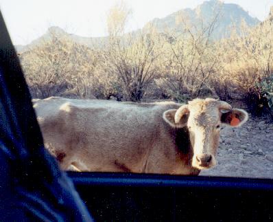
This year Marilyn and I made the trip out to San Juan de la Costa together with Richard and Mary Lou Adcock. The trip was prompted by a La Paz newspaper article announcing that the governor had recently inaugurated a new facility to raise yellow-fin tuna for the Japanese market. It had been said that Mitsubishi was financing this endeavor, and that it would restore employment to the many people who lost jobs when the mine shut 
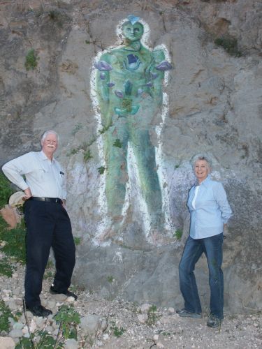
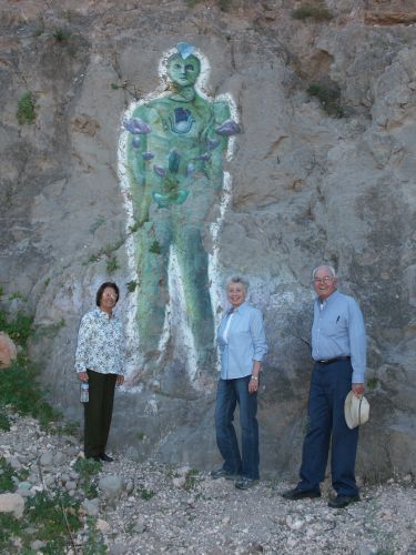
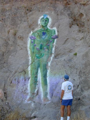
down. We also made a planned side trip to see how the "Glowman" mural had survived the heavy rains since my last visit.

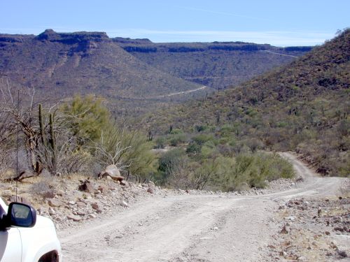
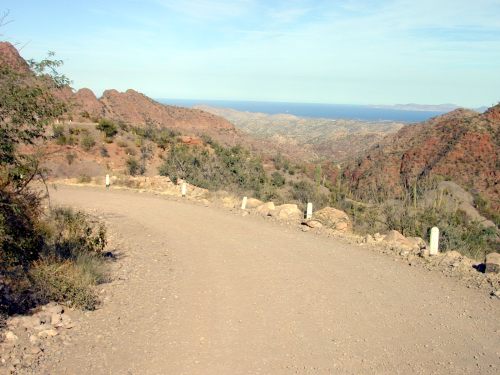
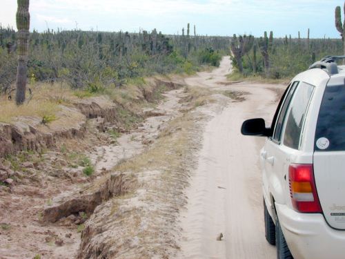
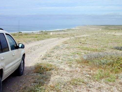
The highway up to San Juan was good in parts, and only fair in others. There was considerable damage to the road resulting from hurricane Marty in September of 2003, but the most serious breaks in the road are being repaired. Watch for areas of potholes.

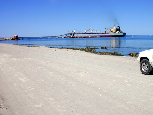
The town is completely shut down and gated at the entrance. Following hurricane Marty, it's clear that the mine will not reopen. The long dock used to convey the ore out to a waiting ship was completely lost (see the March 2001 report below for a photo of the pier), and there was surely considerable damage to the exposed mine equipment. What was most surprising to us was the complete absence of any indication of a budding tuna farm! There was no sign at all that any activity is taking place. Either the tuna farm is being located many miles north of the mine area, or it's still someone's dream (being hijacked by the local politicians and mis-reported by the paper).

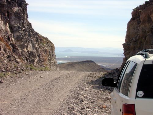
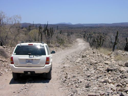
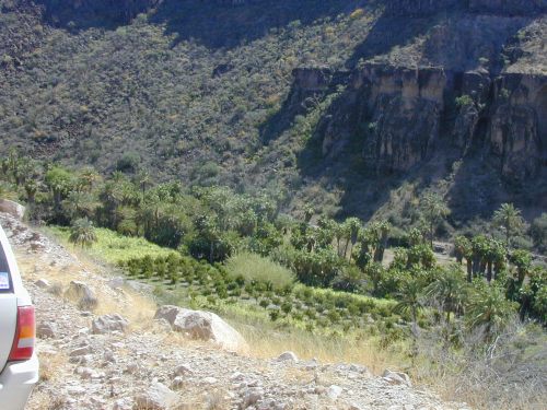
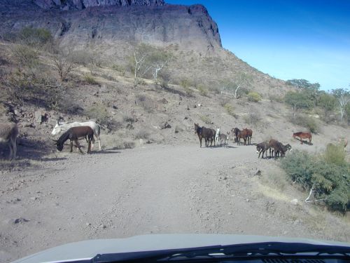
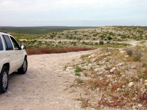
The road back to the Glowman mural also suffered damage from hurricane Marty. Where the road used to split, with an easy route bearing to the right along a stream bed, the only available route is now the more difficult one which crosses the stream bed and climbs the hill to the south. My feeling was that, especially on the return climb, four-wheel drive was a definite requirement. (If you're not in a four-wheel drive vehicle and find yourself at the top of the hill looking down at a rocky and steep climb back up, think real hard about how your vehicle is going to cope with the return trip - there's no other road out that I know of). Since the fence cutting off the ranch from the San Juan road was broken in the stream area by the hurricane, the gate seems to have been left permanently down. 
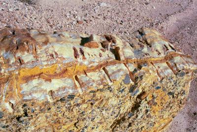
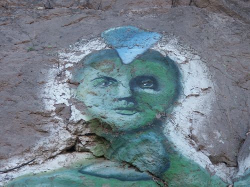
The mural has probably had some more pieces of the rock broken off, but for the most part looked the same.

Glowman 3
Glowman 4
Glowman 5
Click photo for a larger image

February 2003

View 4
View 5
View 6
Click photo for
a larger image

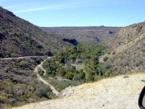
Jack Swords and I drove out to San Juan de la Costa to check out the situation at the phosphate mine which had to shut down after flooding in the tunnels from Hurricane Juliette. We also intended visiting the "Glowman" mural located about 2-3 miles up the canyon that carries the stream just to the south of the town.

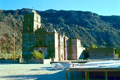
The phosphate mine is, indeed, shut down. The town had a watchman at the gate to the mine area, and a few children playing in a school yard, but was otherwise deserted.

One consequence of this is that the paved road is not being well-maintained. There were numerous potholes appearing, and some roadside damage. The dirt road continuing north to San Evaristo had a heavy washboard.

Another consequence of the closure is that we were able to 
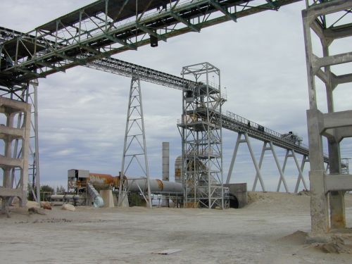
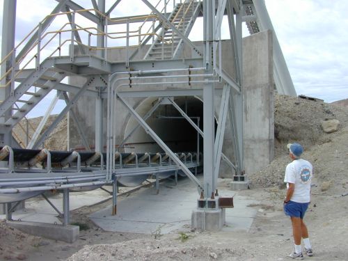
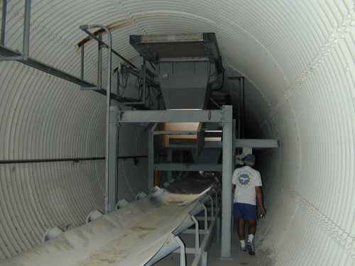
explore the usually off-limits area where the conveyor belts carried the phosphate out to the loading dock. Several photos are included here.

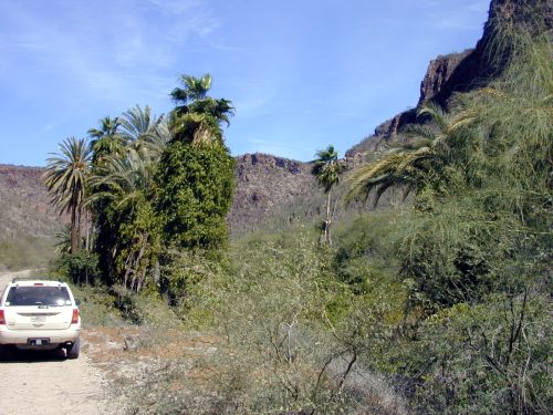
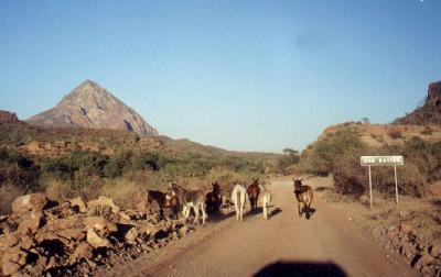
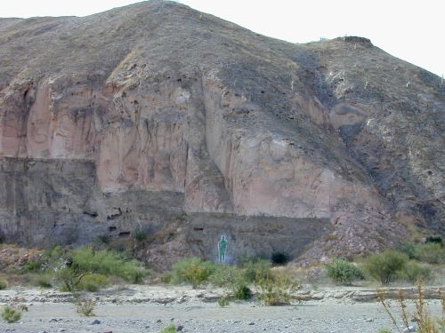
Our visit to the mural, which seems to have acquired the name of "Glowman," took us a couple of miles up the canyon formed by the stream running just to the south of the town. Turn to the left just after crossing the stream on the paved road into town. There is a ranch gate to be passed through - just be sure to close the gate after passing through. The mural, quite modern in origin, will be seen on a rock wall off to your left after the canyon opens up. A couple of photos are shown below.

Glowman 1
Glowman 1
Click photo for a larger image

March 2001

View 1
View 2
View 3
Click photo for
a larger image
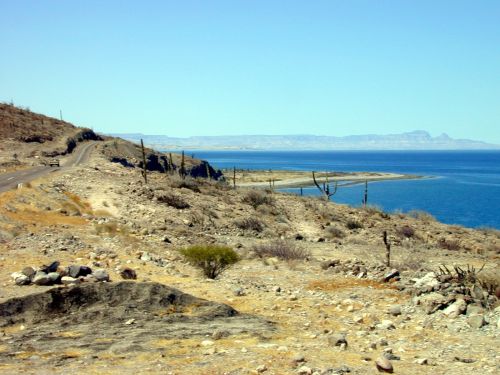
The road to San Juan de la Costa, on the west side of Bahía de La Paz, branches off of Highway 1 just north of El Centenario. The road is paved as far as San Juan, and then continues as a dirt road to San Evaristo (where another dirt road climbs away from the bay and eventually meets Highway 1 again at Las Pocitas).

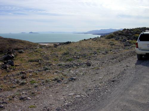
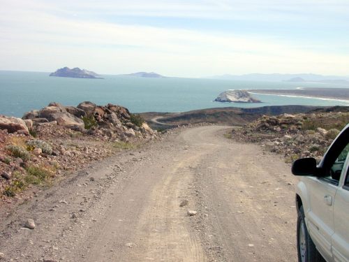
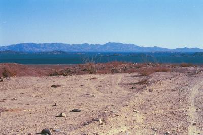
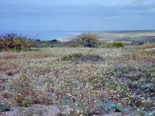
The road closely parallels the water on its way to San Juan. The views of the La Paz peninsula, Islas Espiritu Santo and San Jose 
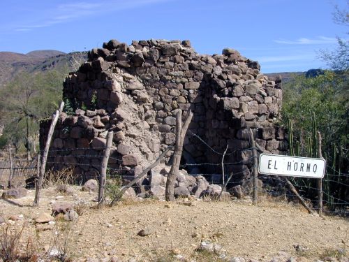
are quite spectacular. San Juan is a "company town" associated with the phosphate mine operated by RofoMex. The mining operation is immense, and the product is loaded onto ocean-going ships by means of a large conveyor belt.

For a legend concerning this area see "The Legend of Mechudo" on the Tales of Baja page ( click here to go there directly ).

Note (February 2002). It has been reported that, due to damage from Hurricane Juliette in October (2001), the phosphate mine has had to shut down. I've not heard if this is temporary or permanent.


Contents Page: http://math.ucr.edu/ftm/baja.html Copyright 2002-2011 Fred T. Metcalf