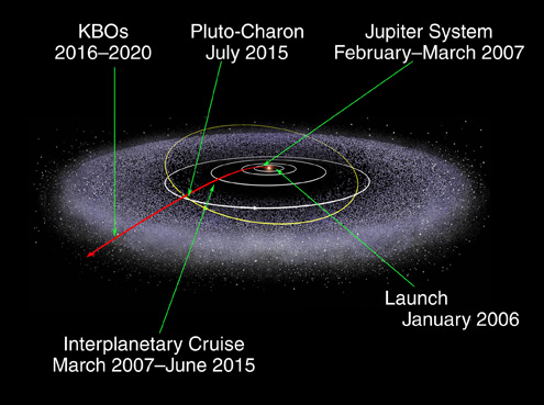
We're going on a great adventure! New Horizons has already taken great photos of volcanoes on Jupiter's moon Io. It's already closer to Pluto than we've ever been. And on 14 July 2016 it will fly by Pluto and its moons Charon, Hydra, and Nix!
But that's just the start: then it will go to see some KBOs!
The Kuiper Belt stretches from the orbit of Neptune to almost twice as far from the Sun. It's a bit like the asteroid belt, but much bigger: 20 times as wide and 20 - 200 times as massive. But while most asteroids are made of rock and metal, most Kuiper Belt Objects or 'KBOs' are composed largely of frozen methane, ammonia and water.
The Earth's orbit has a radius of one astronomical unit, or AU. The Kuiper Belt goes from 30 AU to 50 AU out. For comparison, the heliosphere, the region dominated by the energetic fast-flowing solar wind, fizzles out around 120 AU. That's where Voyager 1 is now. New Horizons will fly through the Kuiper Belt from 2016 to 2020... and, according to plan, its mission will end in 2026. How far out will it be then? I don't know! Of course it will keep going...
For more see:
You can read an expanded, more detailed version of my December 1-5 diary entries here:
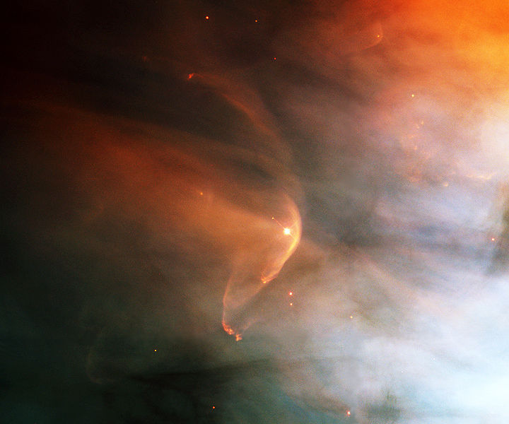
As this young star moves through the Orion Nebula at supersonic speeds, the interstellar gas hits the fast wind of particles shooting out from the star and creates a bow shock half a light-year across. It's a bit like when a boat moves through the water faster than the speed of water waves.
There's also bow shock where the solar wind hits the Earth's magnetic field. It's about 17 kilometers thick, and located about 90,000 kilometers from Earth.
For a long time scientists thought there was a bow shock where the Sun's solar wind hit the interstellar gas nearby. But this was called into question in 2012 when a satellite called the Interstellar Boundary Explorer (IBEX) discovered the solar system is moving slower relative to this gas than we thought! This satellite isn't actually going there — it's in Earth orbit, looking out. But Voyager 1 seems close to hitting the heliopause, where the Earth's solar wind comes to a stop. And it's seeing strange things!
The star in the picture is called LL Orionis, and this picture was taken by the Hubble Telescope in February 1995.
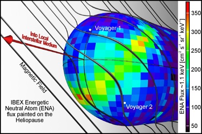
The Sun shoots out a hot wind of ions moving at 300 to 800 kilometers per second. They form a kind of bubble in space: the heliosphere. These charged particles slow down and stop when they hit the hydrogen and helium atoms in interstellar space. But those atoms can penetrate the heliosphere, at least when they're neutral — and a near-earth satellite called IBEX, the Interstellar Boundary Explorer, has been watching them! This picture shows what IBEX has seen.
In December 2008, IBEX first started seeing energetic neutral atoms penetrating the heliosphere. By October 2009 it had collected enough data to see the IBEX ribbon: an unexpected arc-shaped region in the sky has many more energetic neutral atoms than expected. You can see it here!
The color shows how many hundreds of energetic neutral atoms are hitting the heliosphere per second per square centimeter per keV. A keV, or kilo-electron-volt, is a unit of energy. Different atoms are moving with different energies, so it makes sense to count them this way.
You can see how the Voyager spacecraft are close to leaving the heliosphere. You can also see how the interstellar magnetic field lines avoid this bubble. Ever since the IBEX ribbon was detected, the IBEX team has been trying to figure out what causes it. They think it's related to the interstellar magnetic field. The ribbon has been moving and changing intensity quite a bit in the couple of years they've been watching it!
Recently, IBEX announced that our solar system has no bow shock — a big surprise. Previously, scientists thought the heliosphere created a bow-shaped shock wave in the interstellar gas as it moved along, like the wake of a boat.
December 4, 2012
Get to know your neighborhood!
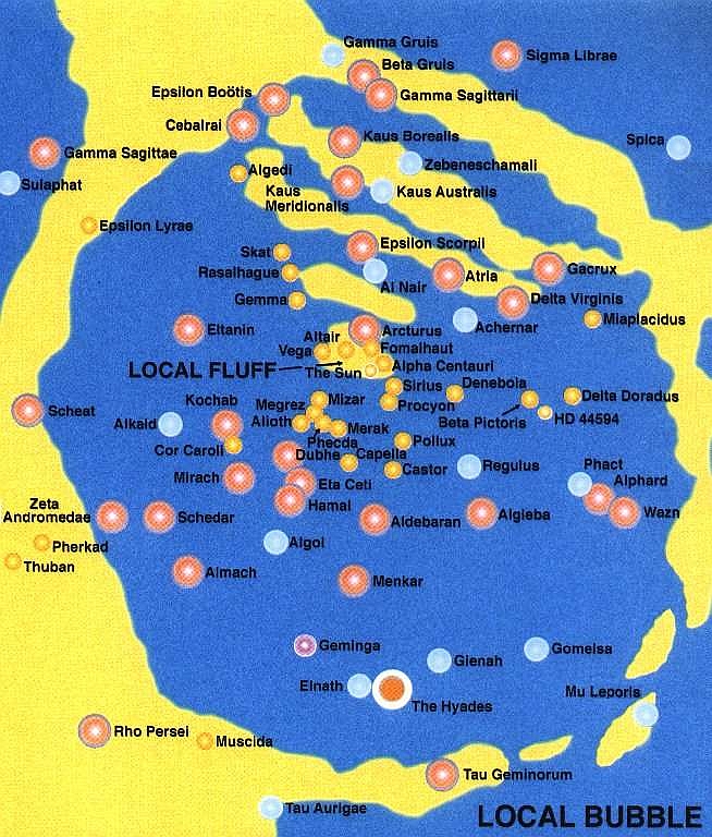
I love the names of these nearby stars! Some I knew: Vega, Altair, Fomalhaut, Alpha Centauri, Sirius, Procyon, Denebola, Pollux, Castor, Mizar, Aldebaran, Algol. But many I didn't: Rasalhague, Skat, Gaorux, Pherkad, Thuban, Phact, Alphard, Wazn, and Algieba! How come none of the science fiction I've read uses these great names? Or maybe I just forgot.
The Local Bubble is a bubble of hot interstellar gas 300 light years across, probably blasted out by the supernova called Geminga near the bottom here. But several thousand years ago we entered a cloud of cooler, denser gas: the Local Fluff. We'll leave this in at most 4 thousand years. But this is just the beginning! As we pass the Scorpius-Centaurus Association, we'll hit bigger, colder and denser clouds — and they'll squash the heliosphere.
When will this happen? People seem very unsure. I read different sources saying we entered the Local Fluff sometime between 44,000 and 150,000 years ago, and that we'll stay within it for between 4,000 and 20,000 years. We'll then return to the hotter, less dense gas of the Local Bubble until we hit the next cloud. That may take at least 50,000 years.
When we hit a big cloud, it will squash the heliosphere: the region near the Sun dominated by the solar wind. Right now this is roughly 120 AU in radius. Before we entered the Local Fluff, it was much bigger. And when we hit thicker clouds, it may shrink down to just 1 or 2 AU!
The heliosphere protects us from cosmic rays. So, when we hit the next cloud, more cosmic rays will reach the Earth. Nobody knows what the effects will be... but life on Earth has survived previous incidents like this, so don't stay awake at night worrying about it!
For more on the neighborhood of our solar system and what to expect as we pass through various clouds, try this great article:
Two candidates for the first cloud we'll hit are the G Cloud and the Apex Cloud. They're close. The Apex Cloud is just 15 light years away:
I have lots of scientific heroes: whenever I study something, I find impressive people have already been there. This week my hero is Priscilla Frisch. She edited a book called Solar Journey: The Significance of Our Galactic Environment for the Heliosphere and Earth. The book isn't free, but this chapter is:
For more, try:
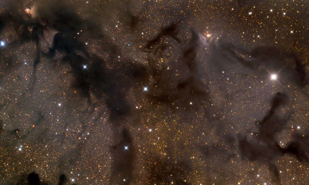
The Aquila Rift is a region of molecular clouds about 600 light years away in the direction of the star Altair. Hundreds of stars are being formed in these clouds.
A molecular cloud is a region in space where the interstellar gas gets
so dense that hydrogen forms molecules, instead of lone atoms. While
the Local Fluff near us has about 0.3 atoms per cubic centimeter, and
the Local Bubble is much less dense, a molecular cloud can easily have
100 or 1000 atoms per cubic centimeter. Molecular clouds often
contain filaments, sheets, and clumps of submicrometer-sized dust
particles, coated with frozen carbon monoxide and nitrogen. That's
the dark stuff here!
December 6, 2012

San Francisco is a wild and crazy city. I got a hotel for a big meeting of the American Geophysical Society at the last minute, in a bad part of town. It was a bit scary seeing such large numbers of beggars and poor folks hanging around on the streets late at night - though none of them bothered me. I overheard a grizzled bum wearing plaid pants and a crazy poncho that looked like a rug walking along talking to a friend. "You're either with them or against them. They don't want you to be a man of your own. And that's something I'm still learning how to do." And near the entrance of the conference I saw a guy shouting at the top of his lungs, "If you want to stop tsunamis and floods, honor your father and mother!"
Both Riverside and Singapore are such tame places by comparison. Even
Bangkok and Hanoi seemed very safe and cozy by comparison.
This picture is not mine; it was taken in San Francisco in 2008 by Doczilla.
December 21, 2012
Today Lisa, my aunt and I began a road trip to Naabeehó
Bináhásdzo.
That's the Navajo Nation, a huge semi-autonomous region, 71,000 square kilometers in area, located at the corners of Arizona, New Mexico, and Utah:

The hole in the middle here is the Hopi Reservation, and we'll also visit that, because we liked it a lot on our previous visit:
On the first day we made it to Kingman, Arizona, a town where the big east-west interstate Route 40 crosses the famous old highway immortalized by Nat King Cole's song: 'Get Your Kicks on Route 66'.
It winds from Chicago to LA
More than two thousand miles all the way
Get your kicks on Route 66
Now you go through Saint Louis
Joplin, Missouri
And Oklahoma City looks mighty pretty
You'll see Amarillo
Gallup, New Mexico
Flagstaff, Arizona
Don't forget Winona
Kingman, Barstow, San Bernandino
Won't you get hip to this timely tip
When you make that California trip
Get your kicks on Route 66!
We got gas at the Canada Mart and asked for a good hotel. Everyone in the store started chiming in, discussing a haunted hotel, one that had rooms named after old Hollywood stars, and so on. We wound up staying at a Best Western.
But the next day, Lisa went back to the Canada Mart and checked out their extensive selection of native American jewelry. Turquoise is used by the Navajo and Hopi, who mainly live at the eastern end of the state, but the best quality turquoise comes from Kingman... where the Mojave live. They call this town Huwaalyapay Nyava. Lisa bought a necklace, and the owner, Donna Hamera, threw in this piece of turquoise for free. Lisa gave it to me:

I love turquoise, but I didn't know what it actually was until I
looked it up just now! It's a hydrous phosphate of copper and
aluminum, CuAl6(PO4)4(OH)8
with four H2O's thrown in. That's complicated!
December 22, 2012

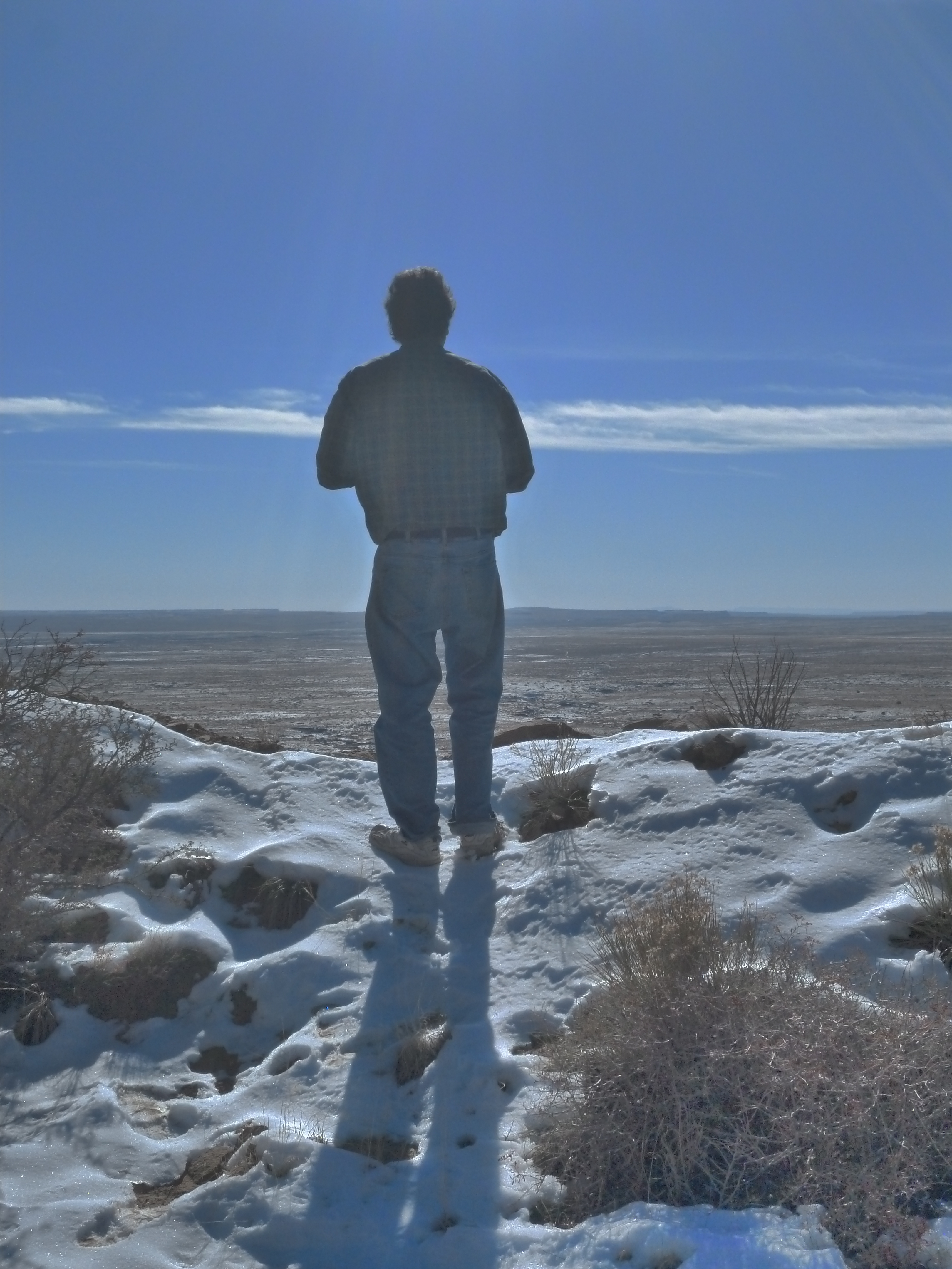
Today we drove to the Navajo Nation. We took Route 40 east to Flagstaff and had lunch at Granny's Closet near the university. Then we cut north on 89 and drove through wonderful red rock country to the Cameron Trading Post. It's fun to see and it has a cool-looking lodge, but it sells goods that are overly touristic and/or overpriced. I took this picture looking out from the trading post.
We continued north to Route 160, took a short drive east to Tuba City, and spent the night at the Moenkopi Legacy Inn. This is a beautiful but somewhat desolate hotel run by the Hopis, who live not in Tuba City proper—that's Navajo—but the adjoining town to the south, called Moenkopi.
Fans of Tony
Hillerman's novels—and if you're not one, you should
be!—will remember Tuba City. It's the largest town in the
Navajo Nation, and it's named after Tuuvi, a Hopi
headman who converted to Mormonism. Apparently they couldn't even get
his name right—or maybe it some other white folks who came along
later were to blame.
December 23, 2012
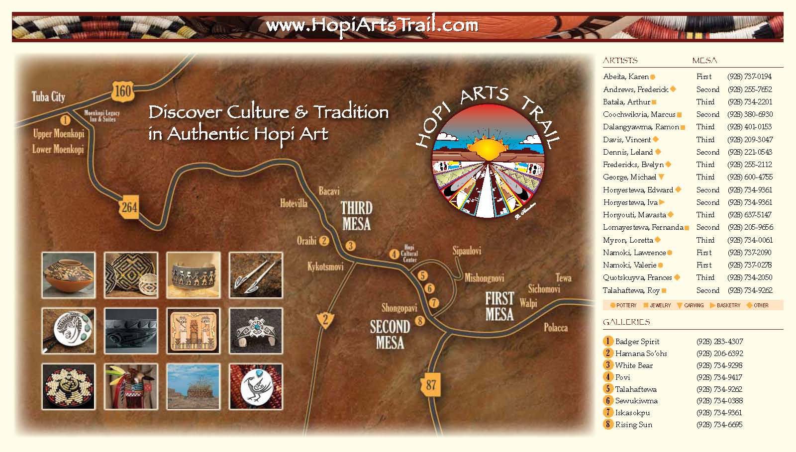
Today after a bit of confusing we drove south and then west
along Route 264 through the Hopi reservation. We saw lots of
great landscapes, even before hitting the famous three mesas:


We stopped at a little store called the Monongya Gallery selling baskets and other goods. It was packed with people, quite a shock in this desolate landscape! Maybe it's because they were having a sale, with lots of stuff 40% off. They were also giving away cookies and coffee. Or maybe people just socialize by meeting at stores. We bought some great stuff at decent prices: some beautiful baskets (made in Mexico according to Hopi patterns, they admitted), and leather thongs for necklaces.
The Monongya Gallery lists its address as P.O. Box 287, Old Oraibi, AZ 86039. Their phone number is 928-734-2344, in case you want to see if they're open. We also stopped at Old Oraibi, which may be the oldest continuously inhabited town in North America. We'd been there on our last trip; it was just as run-down and desolate looking this time, with more dogs than people walking around. Still, it's definitely worth seeing. It has a small art gallery there, and my aunt bought some bookmarks there mainly out of sympathy with the owner. As we left, two old guys tried to sell us stuff, but we didn't buy.
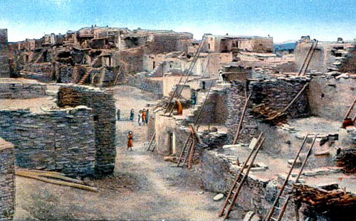
Photography is against the rules at traditional Hopi villages, and we respected that at Old Oraibi. In better days it may have looked like this postcard:
We then proceeded to the nearby Hopi Cultural Center. In the parking lot a young man, so soft-spoken I could barely hear him, sold me a butterfly maiden kachina doll. I bought it out partially out of sympathy: making a living this way must be hellishly hard. I hope he was just trying to get a few extra bucks. But I like it.
We had lunch at the center. Refried beans with lettuce and tomato on fry bread is called a Navajo tostada, tasty but fattening. It's not surprising most of the Indians we saw are obese—and diabetes is rampant here.
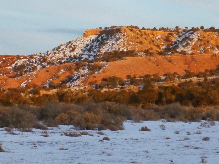
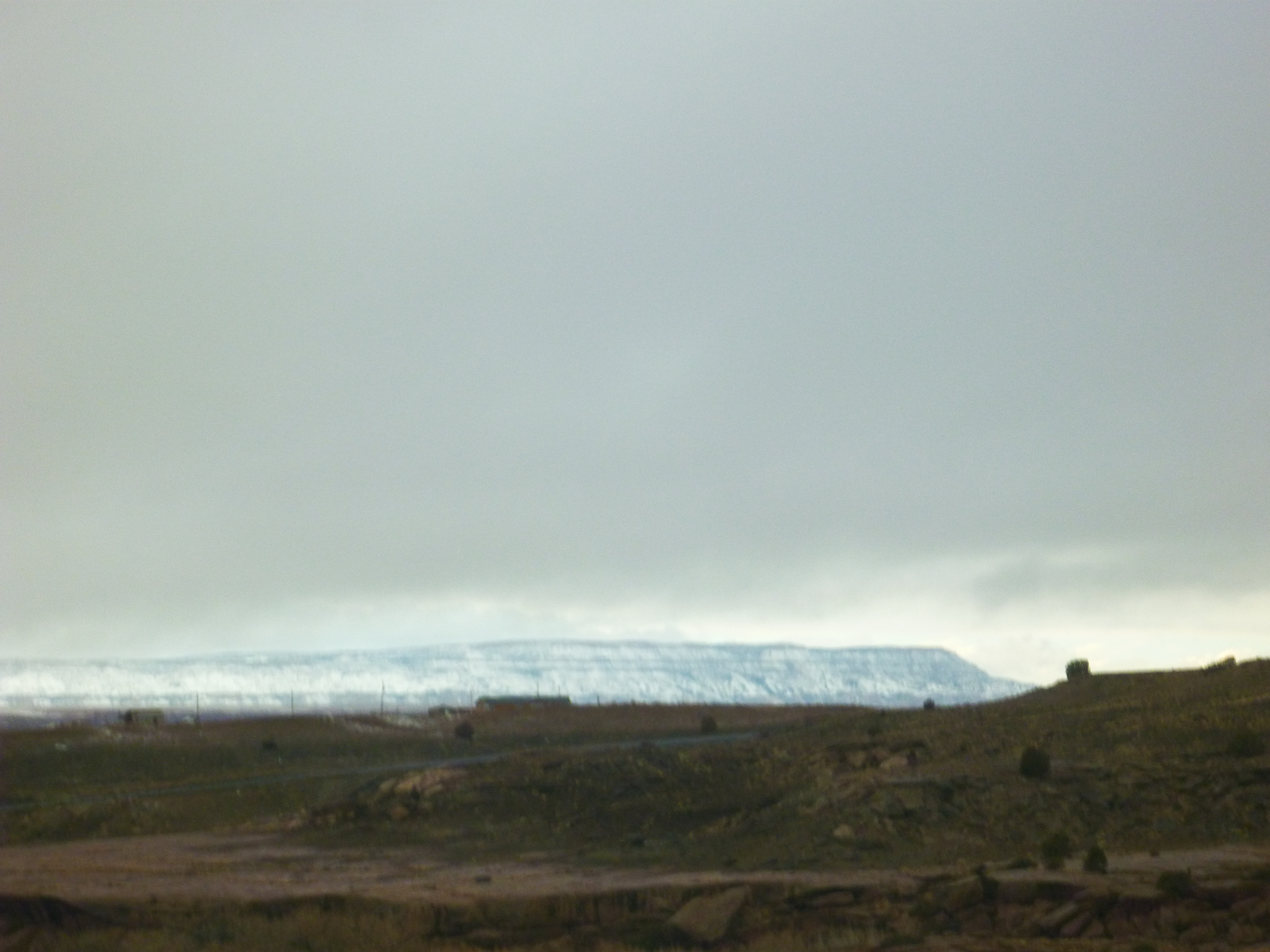
Eventually we reached Route 191 and Ganado, and cut north up Chinle, driving past mesas rendered red by the late afternoon winter sun.
We had dinner at a restaurant in Chinle. Then we drove to the Thunderbird
Lodge and spent the night there, very near our goal: Canyon de Chelly.
December 24, 2012
We weren't sure we could find a Navajo guide who would take us down
to the bottom of Canyon de Chelly on the day before Christmas! But they
had the phone numbers for guides at the nearby Holiday Inn and we got
in touch with one named Timothy who has ready to go right away. So,
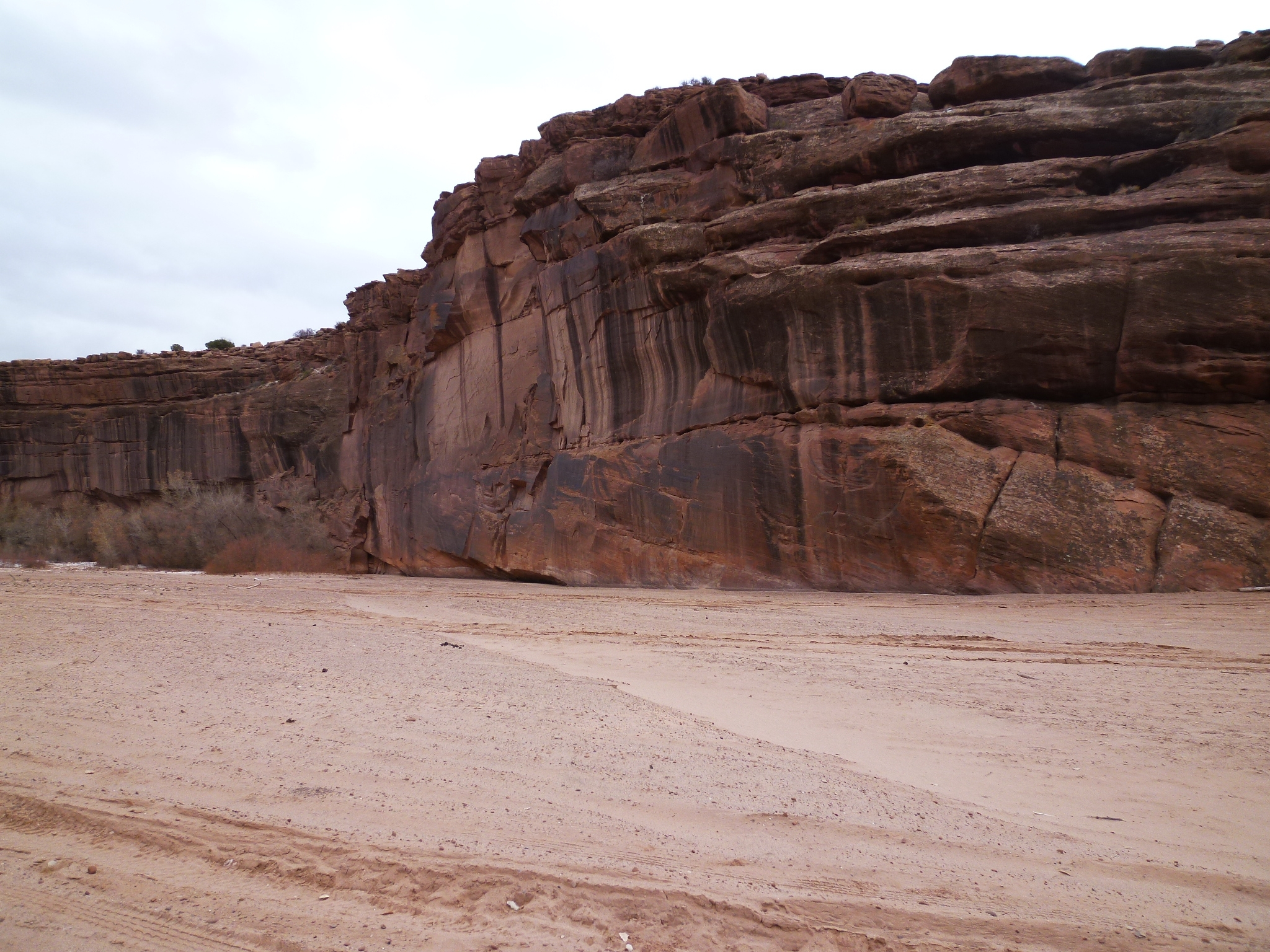
we drove down into the canyon's mouth:
The cliff walls gradually grew taller as we went deeper in:
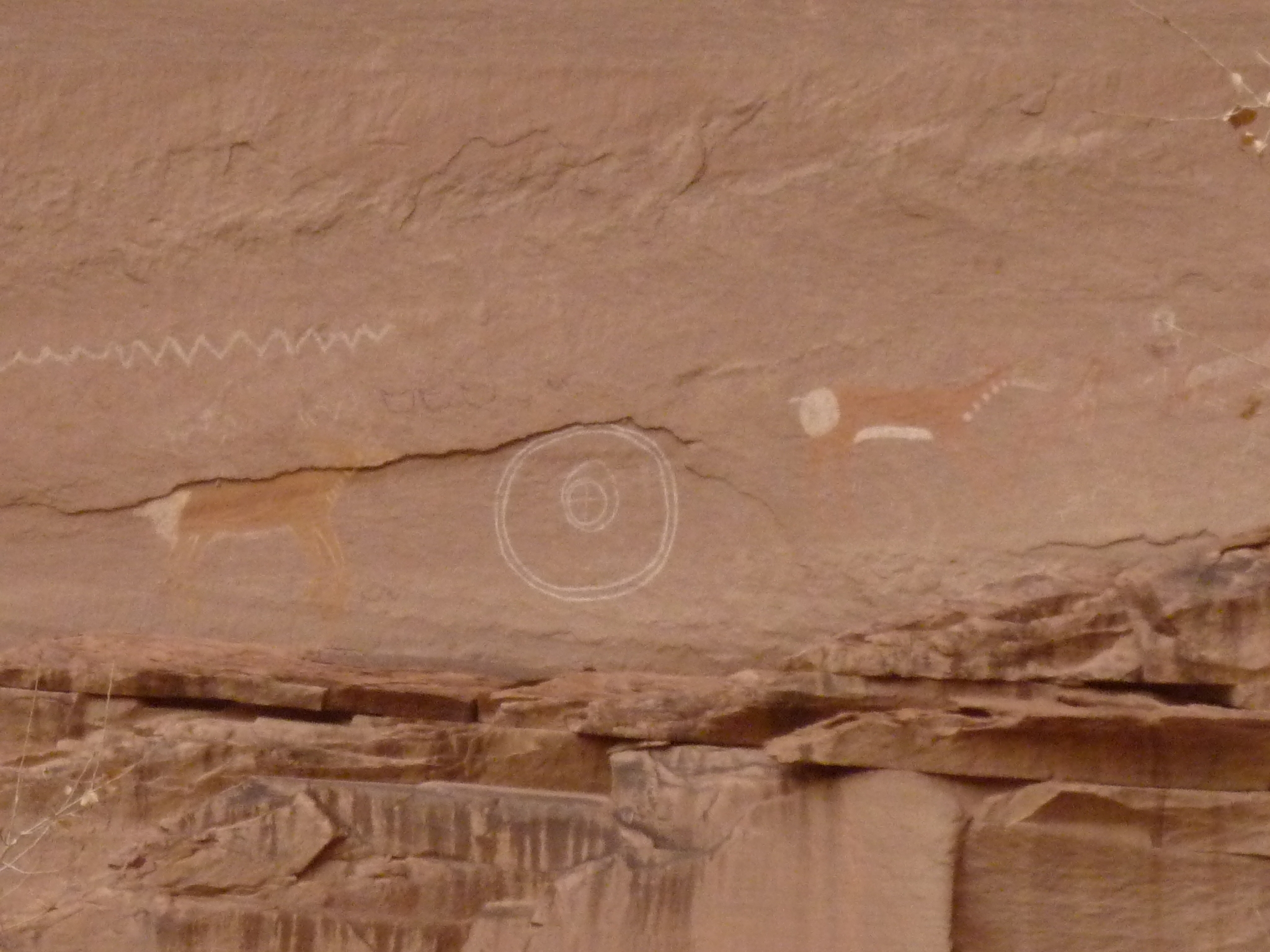
Soon we reached Kokopelli Cave, which is famous for its petroglyphs:

Graffiti on natural rock is considered bad — but if it lasts a thousand years it gets called a 'petroglyph', and it becomes good.

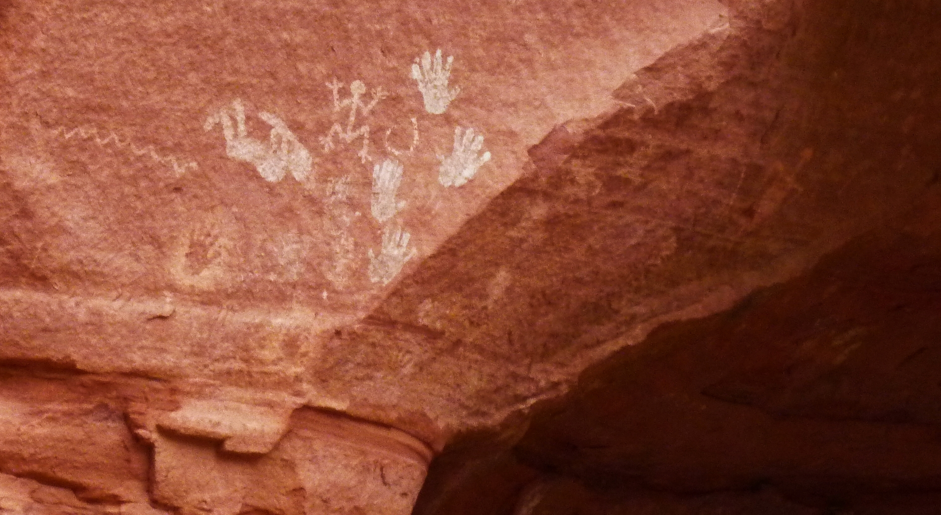
Kokopelli is the hunch-backed flute player here. He's an important character in current-day Hopi mythology, but he goes back to their early ancestors, the ancient Pueblo peoples who built the cliff dwellings here. He's a fertility god, who carries unborn children on his back — and his music brings in the spring. The wiggly line is a snake: a symbol of earth and fertility.
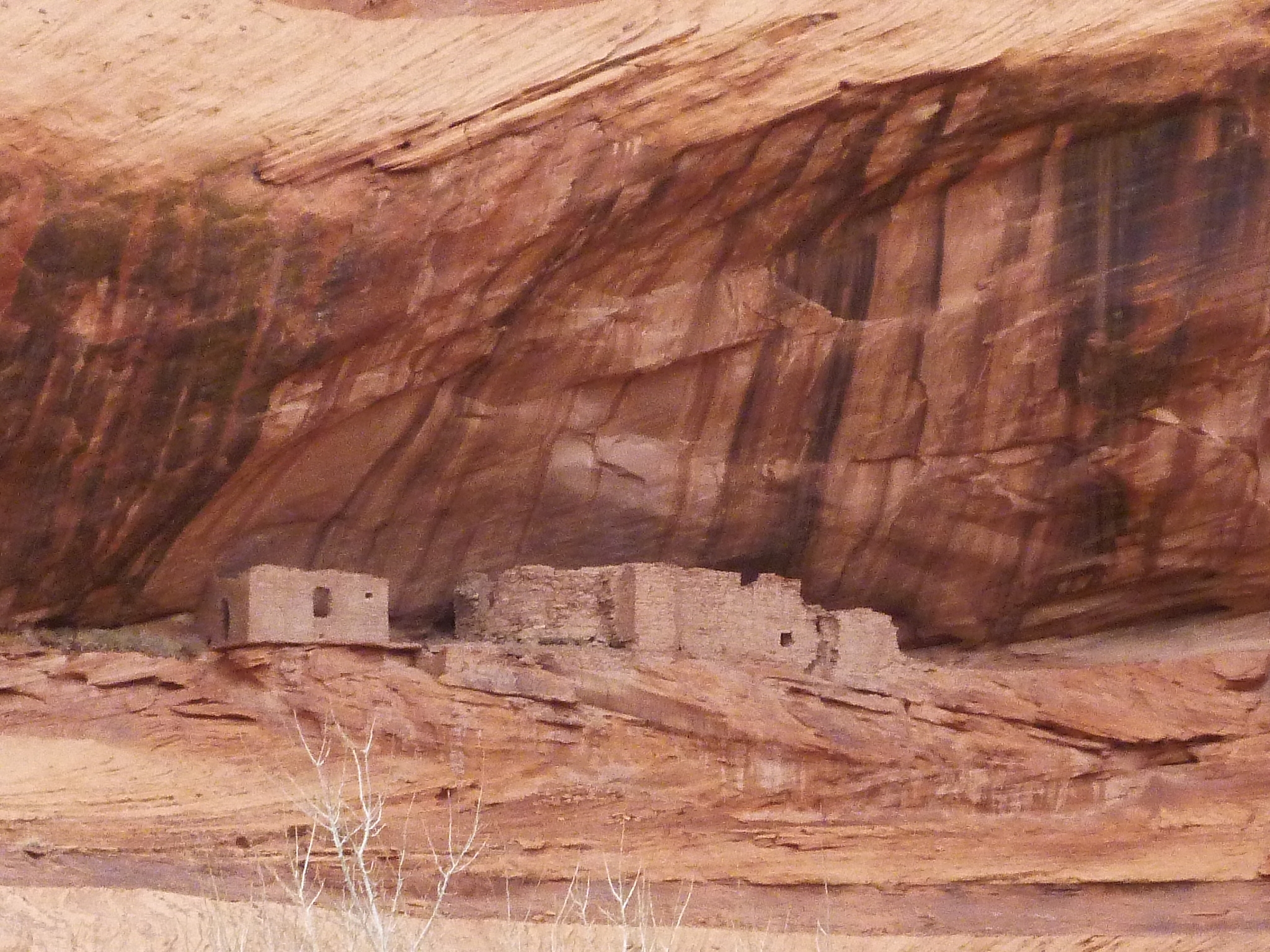
The first cliff dwelling we saw was the aptly named First Ruin:

I've used computer trickery to add a blue sky to this and another picture taken today. In fact it was cloudy, and later it snowed! Click on this photo (or any other) for the true original version.
As we went deeper, the canyon walls got higher and the bottomland because full of cottonwood... as well as smaller weed trees like Russian olive that the Navajo were trying to eliminate because they suck up so much water it's hard to grow crops:

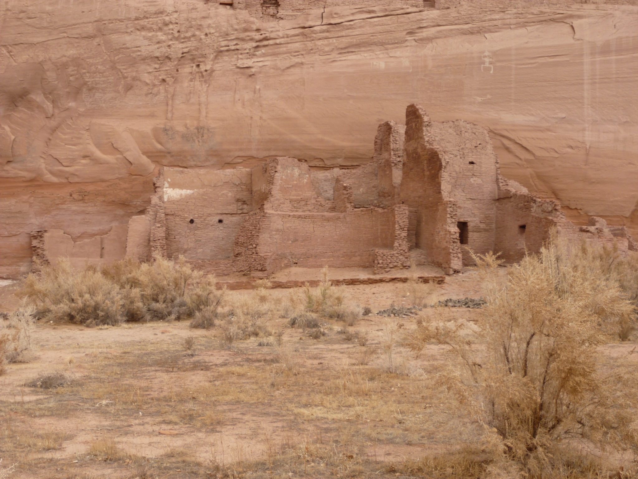
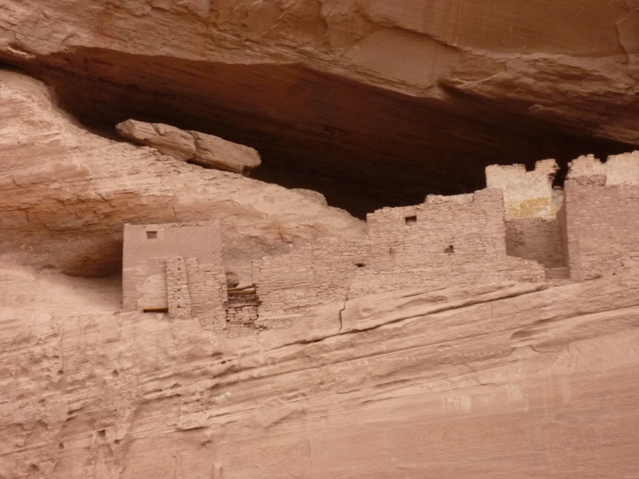
After a bit more driving we reached the junction between the northern and southern branches of Canyon de Chelly. There we saw the aptly named Junction Ruin:

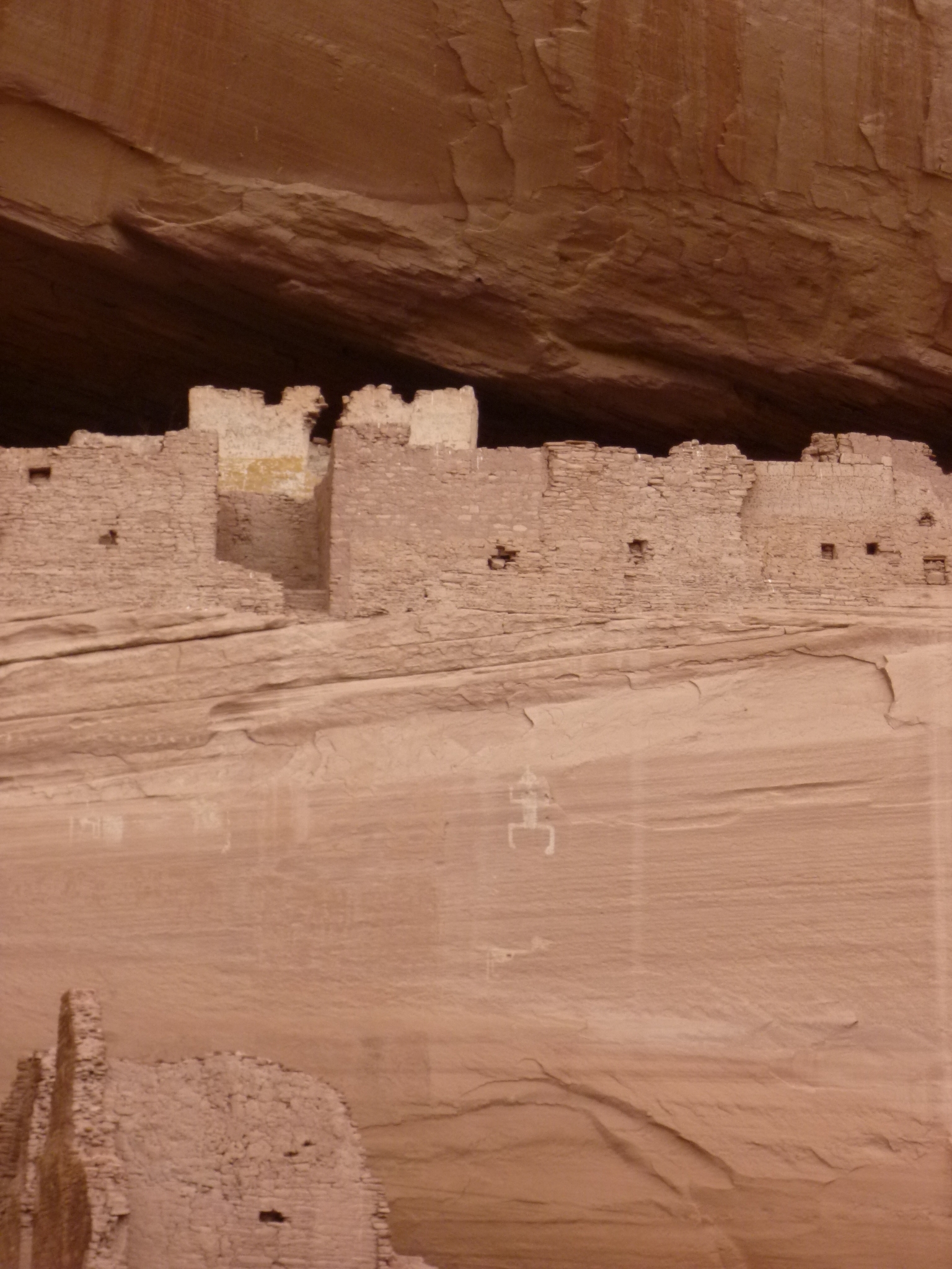
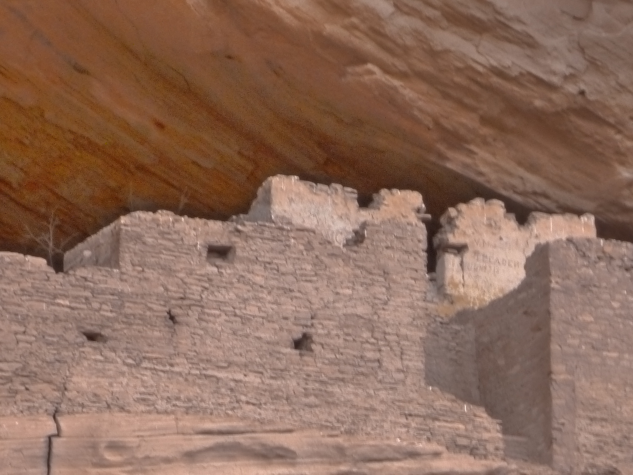
Then we went south to the most famous cliff dwelling in the canyon: the White House Ruin. This is one you can walk to without a guide, so I'd seen it before, in 2005.

Then we drove back up to the junction and explored the north branch of the canyon. Timothy was very good at spotting deer lurking in the brush, like this one:

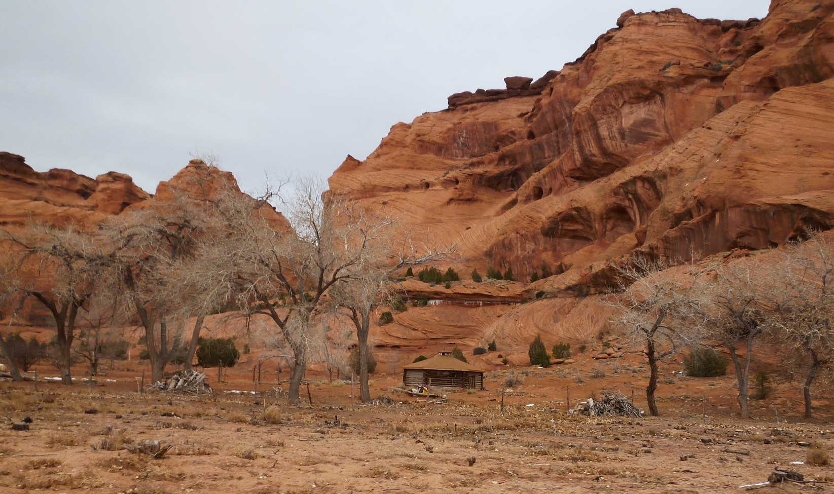
We passed some hogans, too. About 200 Navajo families live in the canyon during summer, growing crops on land they own here. But in winter they move to other homes, so we didn't see many people here, just small groups of horses and cattle.
We then reached Martini Rock. Can you guess why it's called this?

Because it gives you a big hangover.

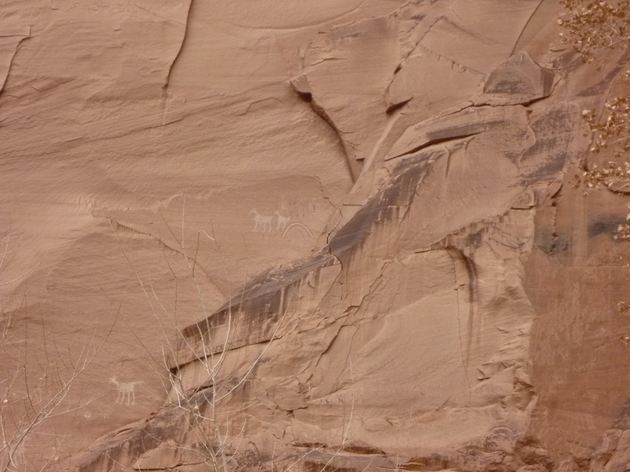
We then reached our destination in the northern branch of the canyon: Antelope House! It's named after the petroglyphs to be found here:

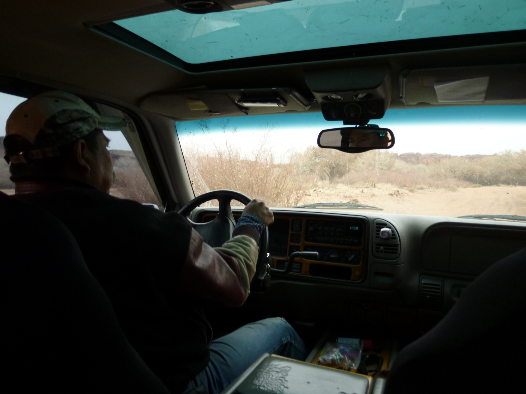
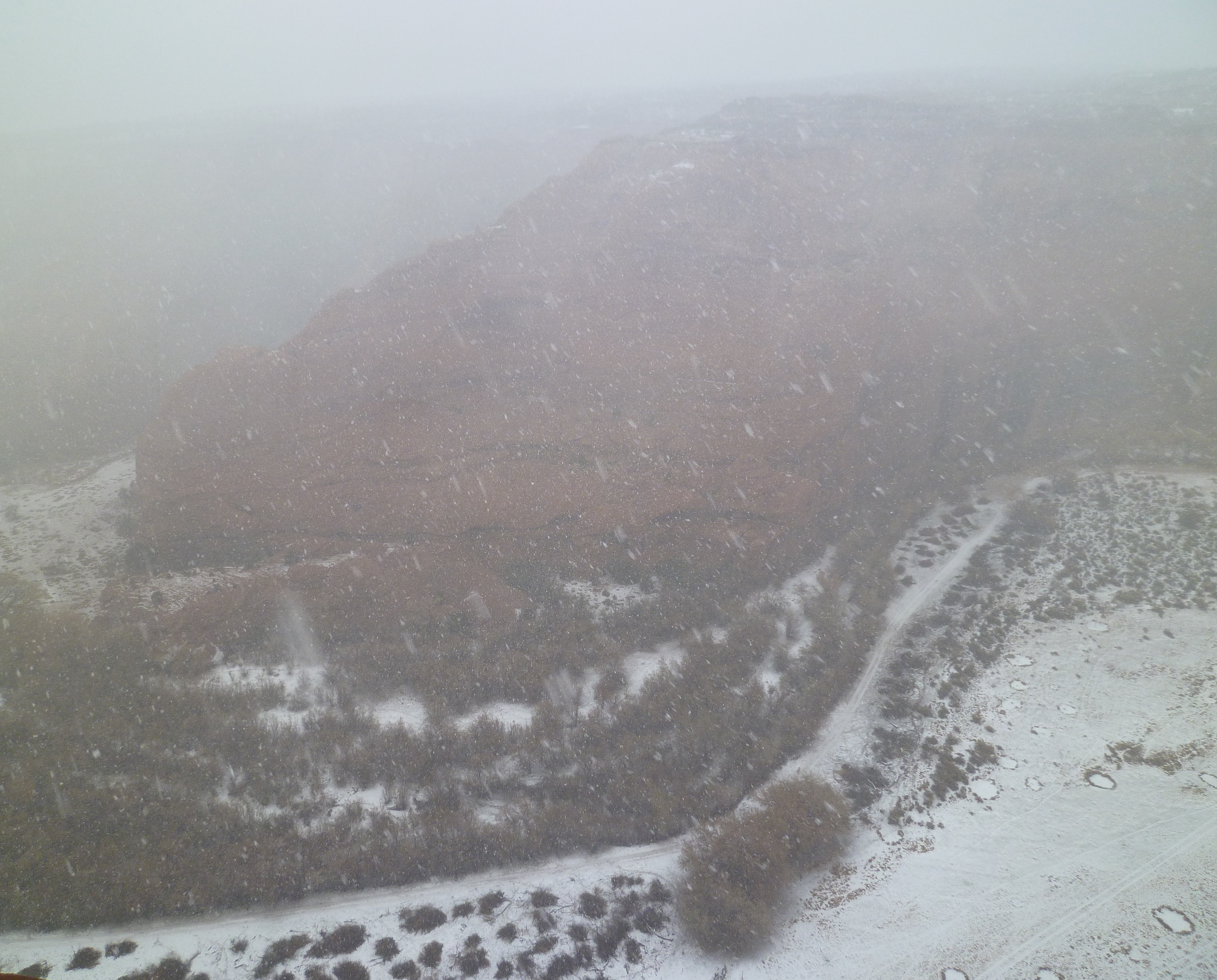
We then beat a hasty retreat as it began to snow in small flurries. We got stuck in the sand, so Timothy called his cousin, who was nearby, to pull us out. Cell phones make such a big difference out in the country!
We went home, had lunch. We took a little drive out through the snow to the southern rim of the canyon...

... but soon the snow started coming down in earnest, so our fear of getting stuck made this trip a short one.
I spent the rest of the afternoon organizing the photos here, while Lisa and my aunt shopped in the Thunderbird Lodge. Lisa got some great moccasins to replace her old and worn-out slippers.
December 25, 2012
Almost everywhere around here is closed on Christmas day, except
luckily the cafeteria at the Thunderbird Lodge, which serves blue corn
pancakes to die for. They're so popular that if you order two they
hand you a little blue sign saying BLUE PAN 2, which you take to your
table!
I drove out through Chinle and south down Route 191, which takes a little jog east at Ganado, and then hits the big interstate 40 at the pathetically puny town of Chambers. I'm only disparaging this poor town because we were looking for some blue corn flour, and the only semblance of a grocery store there seemed to be a gas station, which had ordinary flour but no corn flour. The lonely-looking woman clerk said we could get some in nearby Sanders, to the east. We wanted to head west, but we went to Sanders... and found no blue corn flour at the grocery store.
So, we headed grumpily back west along Route 40, and got more grumpy when we reached the Petrified Forest National Park and discovered it was impossible to enter the park on Christmas. (Makes sense: you wouldn't want thieves making off with petrified logs while the staff were gone on holiday!)
I first heard about Winslow, Arizona in the famous song by the Eagles:
But when we got there we mainly wanted lunch. A guy at a hotel said only two places might be open: the Turquoise Room and La Posada.
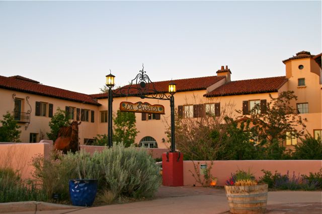
La Posada turned out to be a grandiose and really quite beautiful hotel built in 1929 by the Santa Fe Railway, and designed by Mary Colter, a very good architect who also designed an amazing tower and some other structures I've seen at the Grand Canyon.
But when we went to the hotel restaurant, the maitre d' asked us if we had reservations. When we said no, he looked us up and down and said "Of course you don't." He explained that the only option on the menu was a $50 multi-course Christmas dinner. We weren't in the mood for that, so we left after looking around. My aunt bought a mask at the very well-stocked gift store, and Lisa examined but didn't buy any Indian jewelry.
We got lunch much later, around 3 pm, as we were entering Flagstaff. Then we headed down south to Prescott, first along Route 19 and then cutting up along the 69. (The 169 would have been better, in case you plan to follow in our footsteps.)
We reached the historic downtown of
Prescott a bit after dark, and parked to plan our next move. It
turned out we were parked in front of another rather grandiose and
charming old hotel, the Hassayampa Inn, built in 1927. We
decided to stay there! It was great fun.
December 26, 2012
We left rather early, hoping to get back to Riverside in one day's drive.
We took Route 89 south through the Prescott National Forest. It turned
to be a rather hair-raising ride, full of steep descents and hair-pin
turns. Beautiful, but as the driver I couldn't risk too much gazing
about.
At a little town called Congress we got gas and switched to Route 71. Beautiful view all over, but not too many good photos.

The 71 hit the 60 and we headed southwest on that until we hit the big interstate: Route 10. At this point it became familiar to me, since I've driven across the country many times, and this is one of the ways: through Quartzsite, through Blythe, then Indio, past Palm Springs, Banning, Beaumont, Moreno Valley and then home sweet home: Riverside.
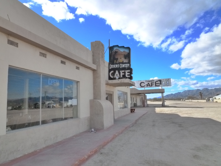
But between Blythe and Indio, looking for a restroom, we stopped at a little town called Desert Center. It turns out to be mostly a ghost town, though it has a population of 204. Of these two cafes, one has definitely been closed for years, while the other claimed to be "closed for repairs". A lonesome place, beautiful in its own way.
By the way, you can read more about the prehistory of Canyon de Chelly and the people who built in my January 2013 diary!
© 2012 John Baez
baez@math.removethis.ucr.andthis.edu